Northeastern Florida Braces for Record Flooding as Storm Systems Shift North
Persistent rainfall has pushed the St. Johns River above record levels, prompting widespread rescues and flood warnings that are expected to last through the Thanksgiving holiday.
By Kevin Koch ·
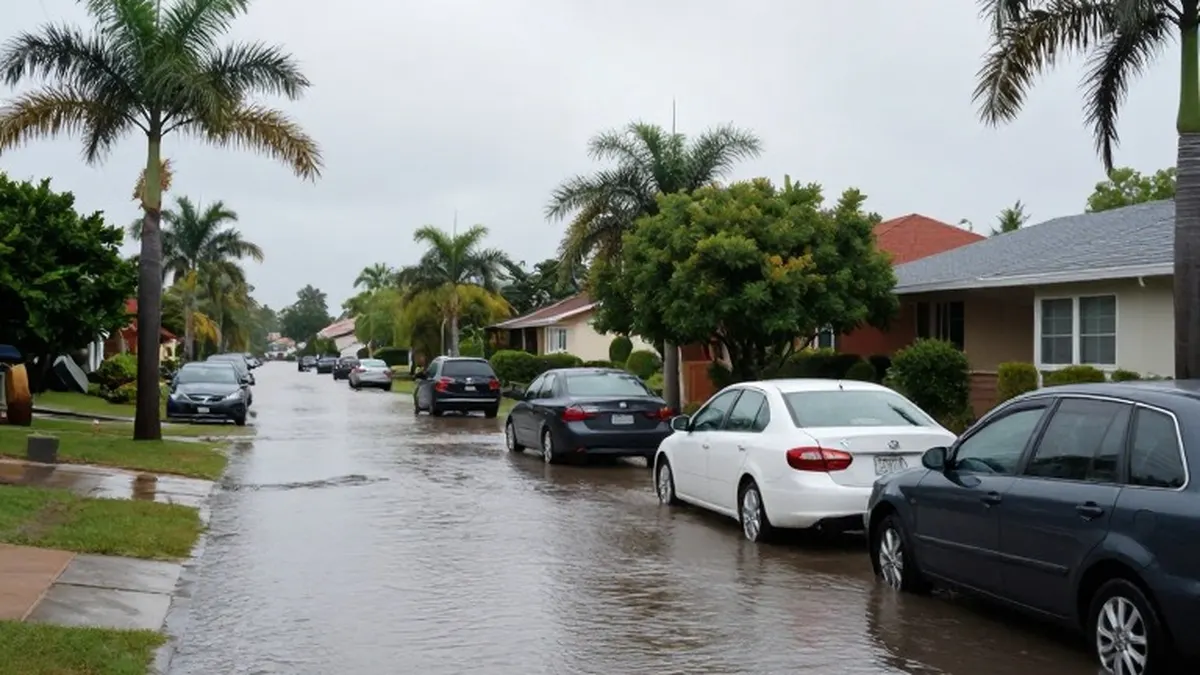
Severe weather systems have moved further north along Florida's Atlantic coast, leaving large areas submerged and triggering dozens of emergency rescues. Forecasters issued warnings on Friday that flooding threats could extend into the following week, with a major river expected to crest significantly above its historical record.
The National Weather Service issued flood warnings and watches covering a span of approximately 200 miles, from just south of Melbourne to the Jacksonville area. Additional rainfall of two to six inches was expected through Saturday, with some specific locations potentially receiving an extra eight to ten inches. The agency described the situation as severe, widespread flash flooding that would affect areas not typically prone to such events, placing lives and property in great danger.
The St. Johns River, the longest river in Florida, surpassed its previous record level near Cocoa on Thursday. That record had stood since 1953. The weather service indicated that the river is forecast to remain at least two feet above flood stage through early next week.
In addition to the rainfall, a nontropical low-pressure system formed on Friday. The National Hurricane Center in Miami stated that this system could develop into a subtropical or tropical storm along the southeastern U.S. coast. Residents in the southeast and mid-Atlantic regions are advised to prepare for strong winds, dangerous surf, and coastal flooding ahead of the Thanksgiving holiday.
Preliminary data shows that parts of Florida's east coast have accumulated more than 17 inches of rain since Tuesday. This heavy precipitation follows significant rainfall earlier in the month, with several locations already recording their wettest November on record. The storms shifted to the Space Coast on Thursday, causing rivers to overflow their banks during what is traditionally considered the state's dry season, which runs from October to May.
Jazmin Foster, a resident of Melbourne, noted that her home had been inundated with water for the second time in two weeks. She remarked that she had never seen such conditions in Florida. In Brevard County, volunteers used trailers to navigate knee-deep water to rescue dozens of horses and other animals at the Blue Lake Equestrian Center in Cocoa. The animals were subsequently moved to a dry pasture.
Sheriff Wayne Ivey reported that first responders conducted nearly 100 high-water rescues across Brevard County, with numbers continuing to rise. The city of Palm Bay implemented mandatory evacuations for some residents in a mobile home community and opened shelters for those displaced from their homes.
The Division of Emergency Management stated that nearly 200 Florida National Guard personnel, equipped with 50 high-water vehicles, have been deployed to assist communities along the coast. Approximately 235 officers from the Florida Fish and Wildlife Conservation Commission are also responding to the situation.
Meteorologists attribute this week's storms to a combination of persistent high pressure over Virginia and a low-pressure system in the Gulf of Mexico. These factors have driven a steady onshore flow across the Florida Peninsula. The systems are considered an offshoot of El Niño, the natural warming of the Pacific near the equator that alters global weather patterns.
Forecasters expect El Niño conditions to persist through the spring. This suggests that extreme, wet weather in Florida and California will likely continue throughout the winter. The California coast, from Los Angeles to San Francisco, also experienced significant flooding this week, with some drivers abandoning stalled vehicles and sections of Highway 1 closed due to rock and mud slides south of the Monterey Peninsula.
More News · National news · Report a business · Got a Story?